Integration of Unmanned Aerial Systems Data Collection Into Day-to-Day Usage for Transportation Infrastructure – A Phase III Project
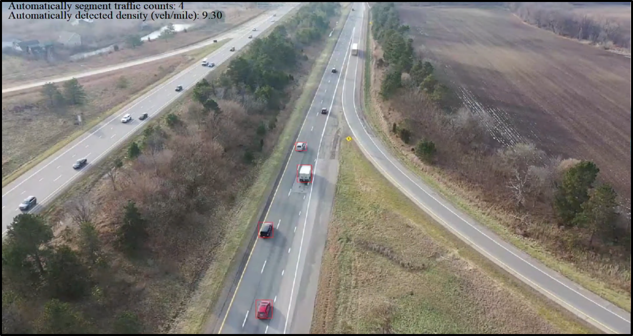
- Project overview: Unmanned/uncrewed aerial systems (UAS) offer advanced capabilities for transportation infrastructure monitoring and condition assessment. This Phase 3 project explored four UAS use cases: traffic operations, bridge inspection, construction inspection, and LiDAR-based design surveys - and their integration into MDOT databases and workflows. Field data collections across Michigan demonstrated how UAS methods generate high-resolution geospatial outputs for MDOT operations. Project report can be found here. Key results included:
- Traffic Operations: Origin-destination analysis and traffic counts.
- Bridge Inspection: Automated detection of spalls/delaminations and 3D bridge models.
- Construction Inspection: Production rates for concrete/asphalt work and BIM data.
- LiDAR Surveys: High-resolution 3D models for design surveys.
- Role: Research Assistant
- Tools: Labeling tool
- Contributions 1: Data labeling for data collected on Williamston Road (I-96) Traffic Corridor.
- Contributions 2: Data analysis for OD insights and vehicle counts validation.